When you click on links to various merchants on this site and make a purchase, this can result in this site earning a commission. Affiliate programs and affiliations include, but are not limited to, the eBay Partner Network.
I know it is prob better suited for riding a sports bike but I enjoy the windy roads up at Tilden park. I recommend checking it out especially at sunrise due to a pretty dam good view of bay.
I know it is prob better suited for riding a sports bike but I enjoy the windy roads up at Tilden park. I recommend checking it out especially at sunrise due to a pretty dam good view of bay.
Do you have specific recommendations so as to be able to generate a Google maps URL, like what's listed in the top post?
For example something like "...from the junction of A and B, take road C to D and..."
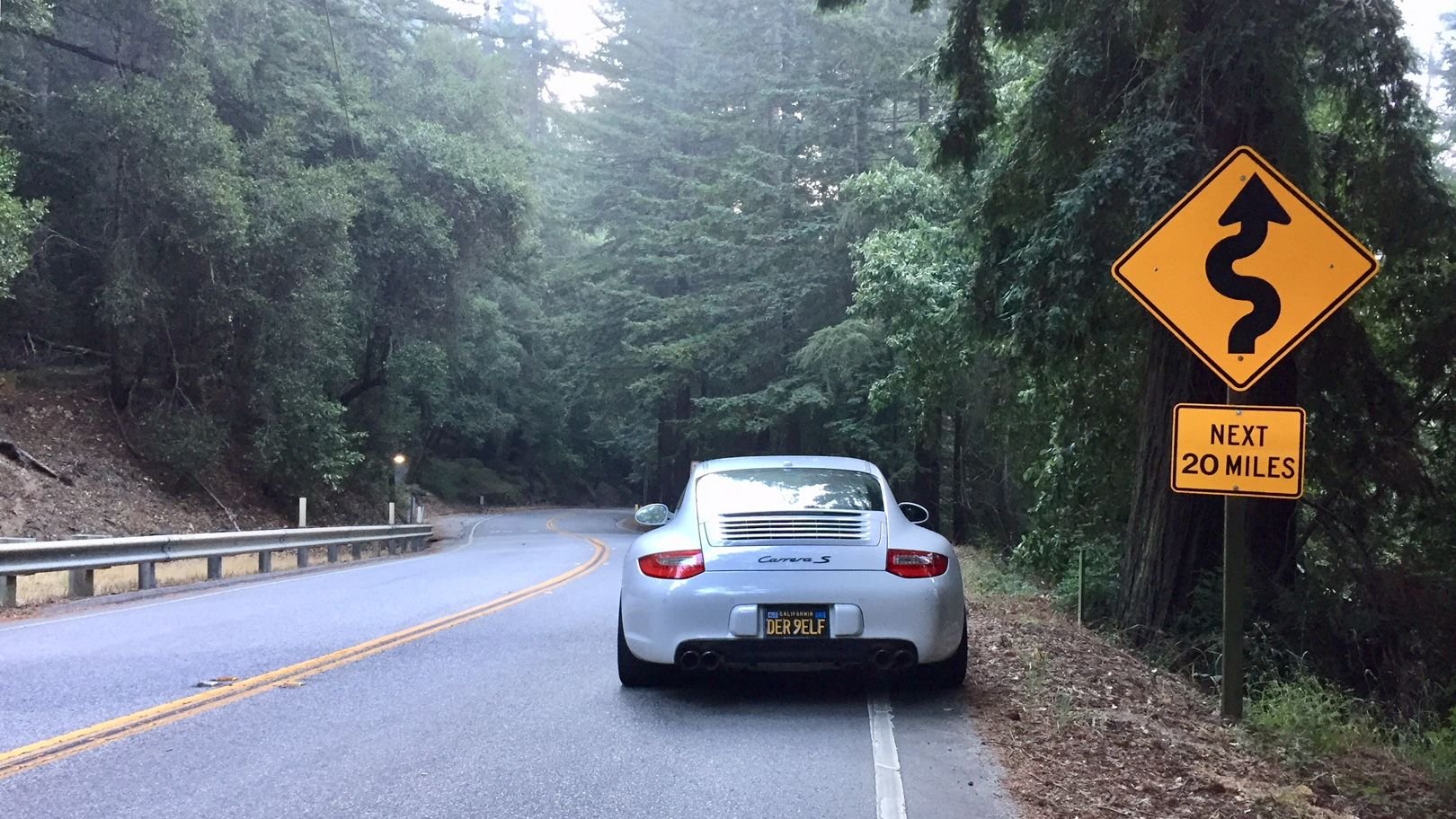
I did that yesterday. DPC Rd to I-5 (east bound) starts with a pretty bumpy surface but then smoothes out. I went after the storm so there were a lot of rock falls from the canyon and pine cones and other debris.
I also took a side trip to Diablo Grsnds, a gated community in the middle of nowhere on a dead end road. The surface is amazing, wide road with shoulders, smooth big sweeping fast turns. There was a bit of light traffic but they seemed to all get out of the way easily and without prompting. It's short, 8miles one way but grab a coffee at the I5 and then tack this on before heading home.
I also took a side trip to Diablo Grsnds, a gated community in the middle of nowhere on a dead end road. The surface is amazing, wide road with shoulders, smooth big sweeping fast turns. There was a bit of light traffic but they seemed to all get out of the way easily and without prompting. It's short, 8miles one way but grab a coffee at the I5 and then tack this on before heading home.
Thanks. I've captured from the security gate back out to I-5 as follows, plus another recommendation...
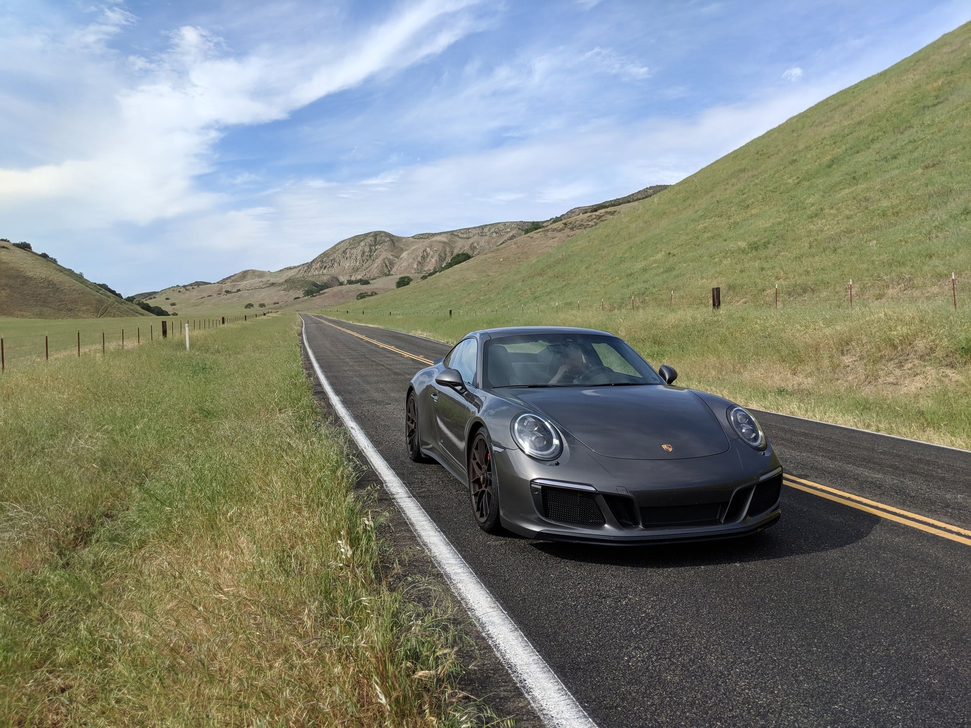
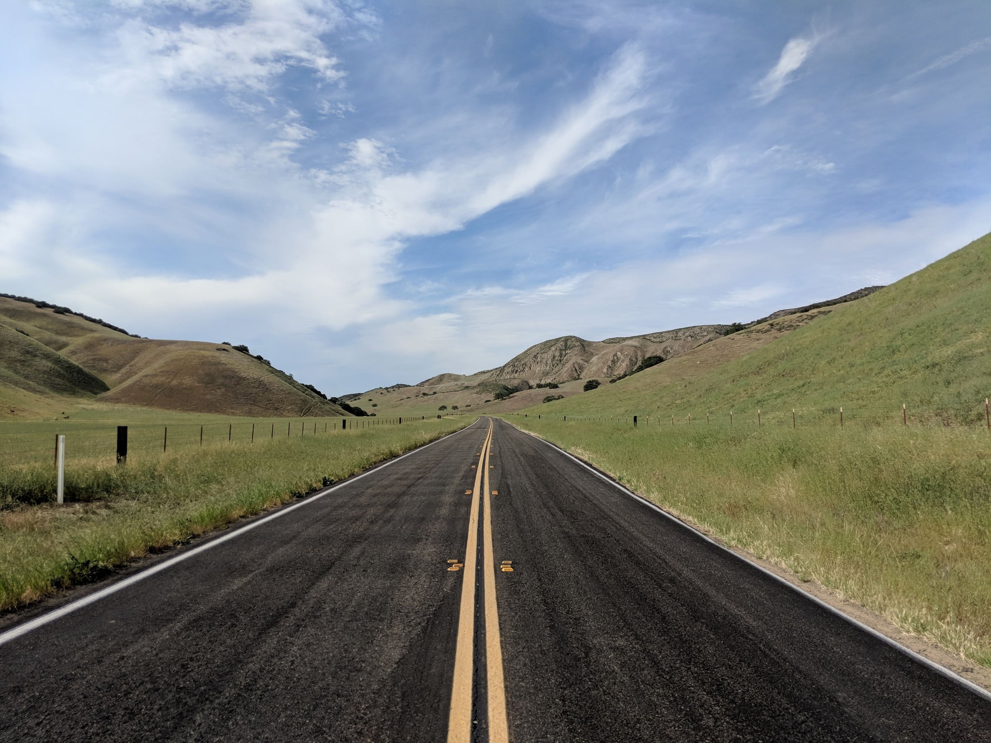
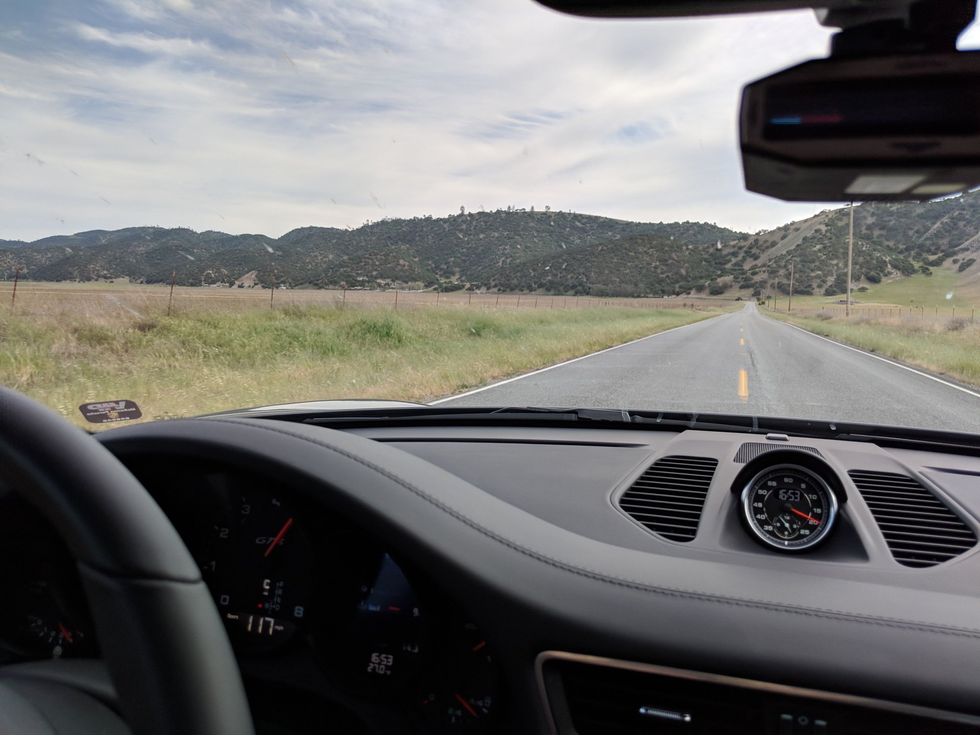
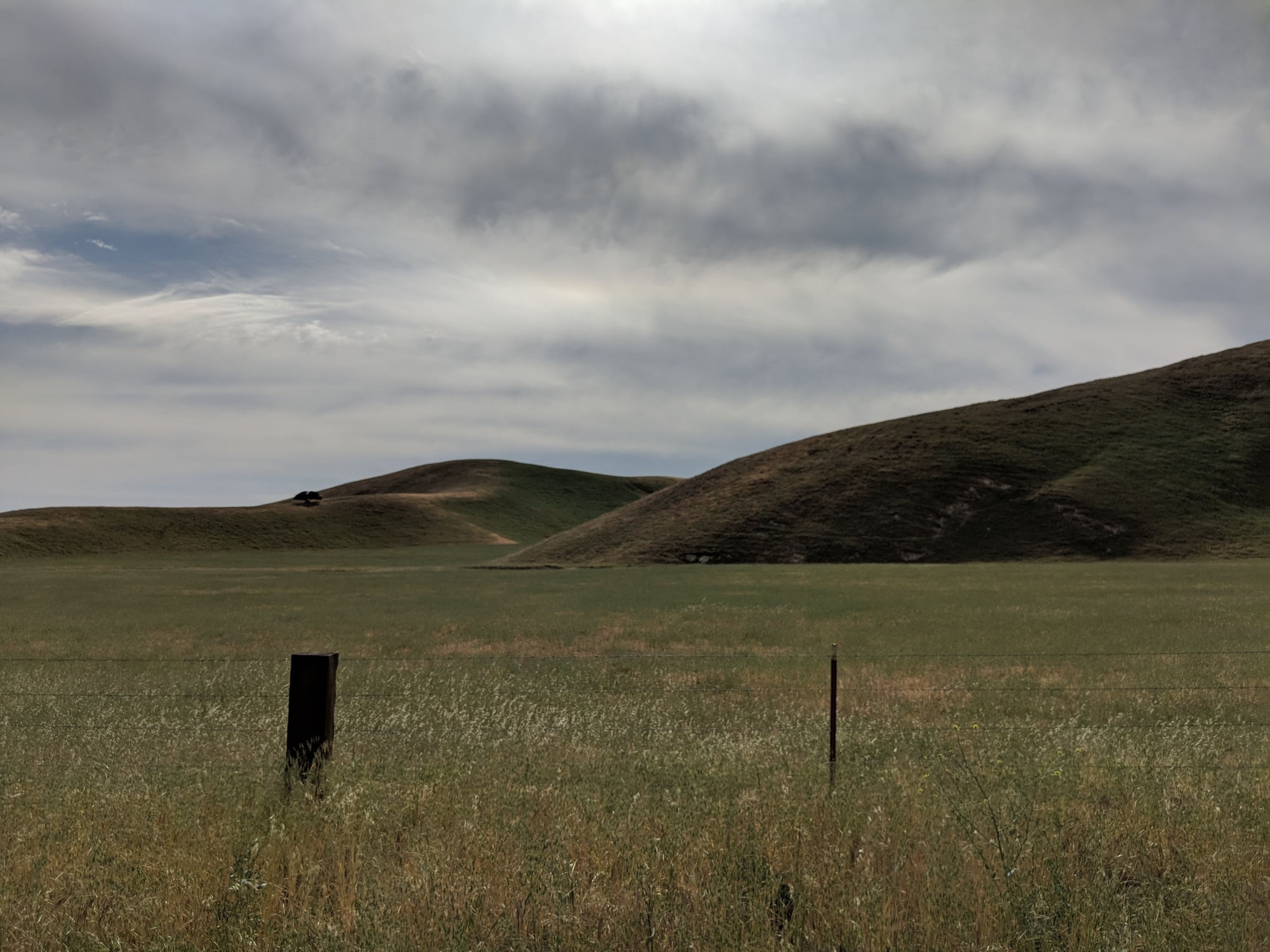
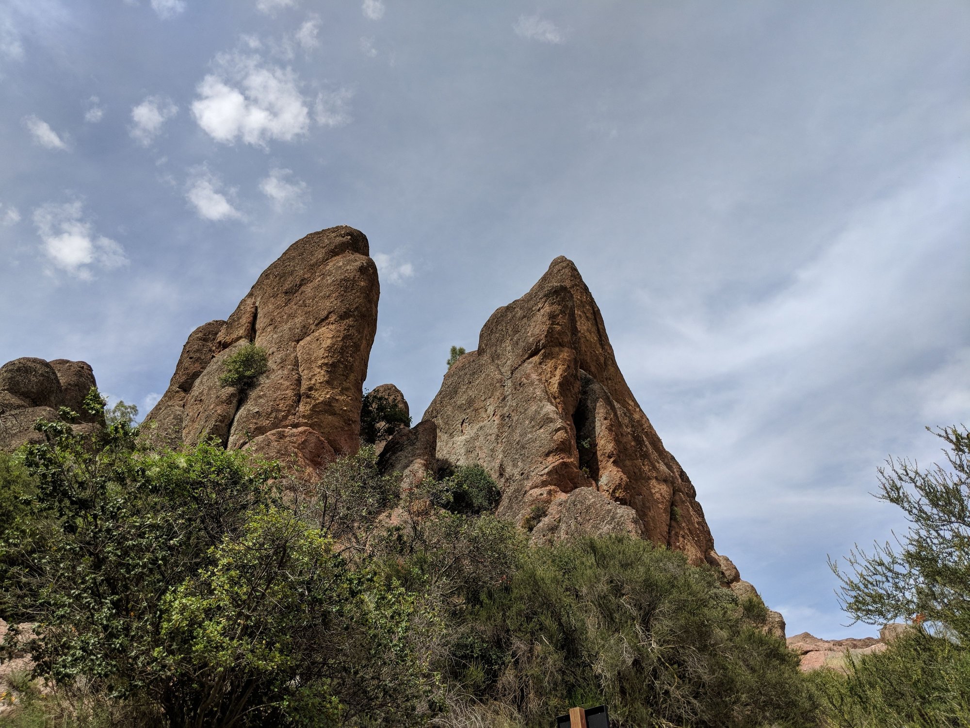
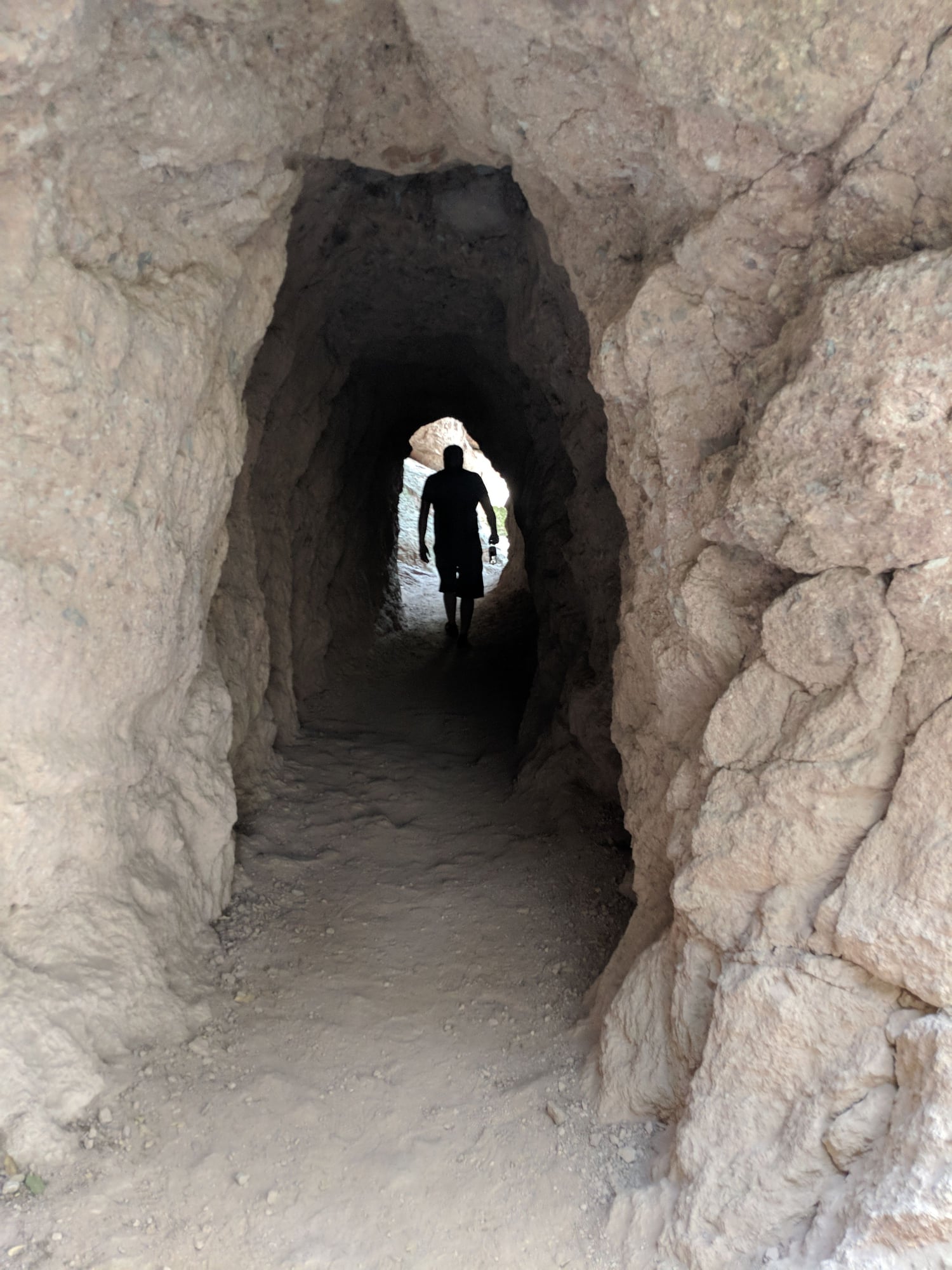
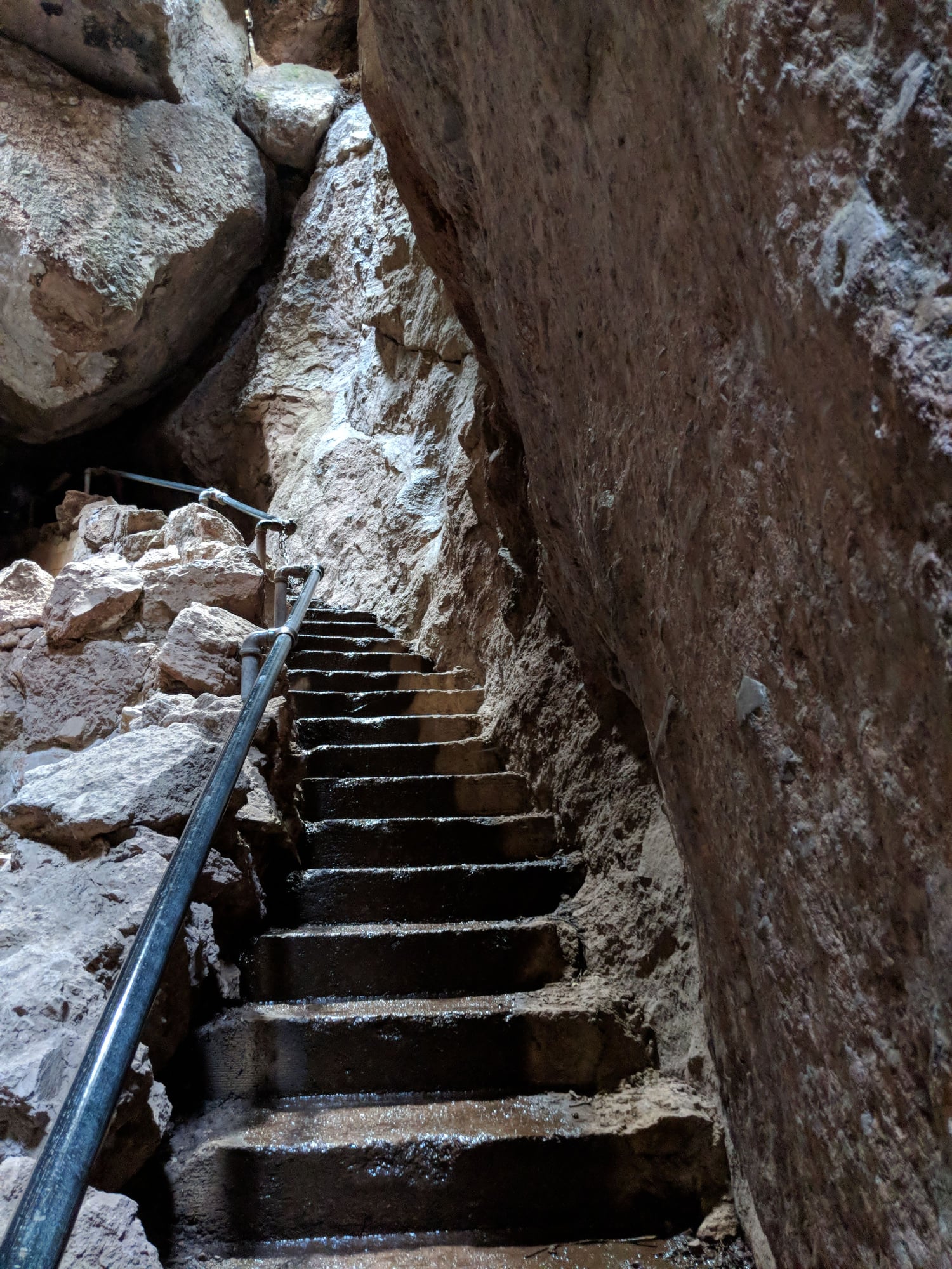
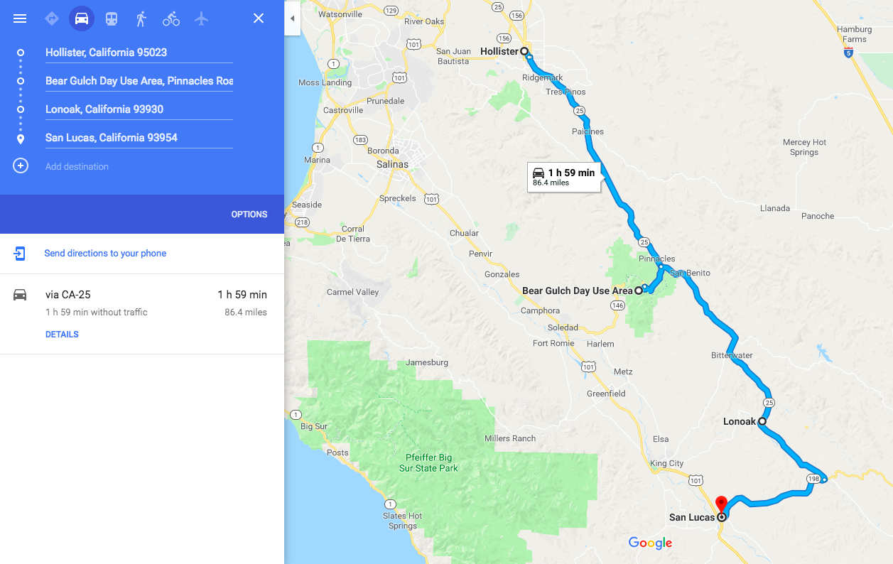
So, not exactly a quick morning ride in the Bay Area but, still well worth it. Decided to try out CA SR25 aka "Airline Highway" between Hollister and San Lucas on the weekend. On the way we dropped into the Pinnacles National Park to do some leg based exercise and not just exercising my gas pedal.
This is the route plan that I followed. I live in SF so took 280 -> 85 -> 101 -> 25 to get to Hollister and then took 101 -> 85 -> 280 from San Lucas back to SF. I didn't have enough time to add other South Bay and Peninsular routes in. All up was about ~380Mile day in the car plus about 2 hours of hiking and lunch.
The stretch of road from Hollister south to the park was pretty nice, not too many cars, with a good mix of twisty and fast. But the real fun as south of the park heading towards 198 before turning West towards San Lucas. Great surface, no cars, no people/houses, just open California rolling hills. Good open sections for getting the turbos spun up (2018 991.2 CS GTS) and lots of nice banked twists.
Below are some pics (map, road and from the park). It was a long day but has to be one of my favorite roads in the area at the moment.
Roadway
Spirited Driving
Rolling Hills
Locals
The National Park
Map
Last edited by iphilips; 05-07-2018 at 10:07 PM.
Reason: Added route map image
Very nice , thanks for sharing iphilips- going to give this a try..
Originally Posted by iphilips
So, not exactly a quick morning ride in the Bay Area but, still well worth it. Decided to try out CA SR25 aka "Airline Highway" between Hollister and San Lucas on the weekend. On the way we dropped into the Pinnacles National Park to do some leg based exercise and not just exercising my gas pedal.
This is the route plan that I followed. I live in SF so took 280 -> 85 -> 101 -> 25 to get to Hollister and then took 101 -> 85 -> 280 from San Lucas back to SF. I didn't have enough time to add other South Bay and Peninsular routes in. All up was about ~380Mile day in the car plus about 2 hours of hiking and lunch.
The stretch of road from Hollister south to the park was pretty nice, not too many cars, with a good mix of twisty and fast. But the real fun as south of the park heading towards 198 before turning West towards San Lucas. Great surface, no cars, no people/houses, just open California rolling hills. Good open sections for getting the turbos spun up (2018 991.2 CS GTS) and lots of nice banked twists.
Below are some pics (map, road and from the park). It was a long day but has to be one of my favorite roads in the area at the moment.
I am planning a 3 day trip with my wife (and the 964) third week of June around Clear Lake, CA. Not sure we can still consider that to be Bay Area but hey, I will be driving from SF.
We'll be staying at the Tallman hotel around the lake, any recommendations of nice roads in the vicinity? Is it a good idea to day trip to Mendocino? We are doing that during the week so it will be a bit quieter. Also, she's super compliant with spirited driving.
So far I have planned great food and great accommodations, it's only missing a proper road book
So, not exactly a quick morning ride in the Bay Area but, still well worth it. Decided to try out CA SR25 aka "Airline Highway" between Hollister and San Lucas on the weekend. On the way we dropped into the Pinnacles National Park to do some leg based exercise and not just exercising my gas pedal.
Wow, what an amazing thread! Thank you Karl for putting this together. I'm taking a trip from SF to Orange County in a few weeks, with a stop in SLO. Here's the route I currently have planned from SF to SLO based on this thread.
What do you think of this route? Some options I'm considering if I want to save some time - (1) skip Kings Mountain Rd to 84 and stay on 35 to Alice's, (2) skip 84 to Alpine Rd and stay on 35 from Alice's, and (3) skip 236. Is there a must drive out of these 3 sections I'm considering skipping?
Would it be better to do this drive on a Saturday afternoon or Sunday morning? Or do both suck so I should shoot for Friday afternoon?
If you are coming south from SF, just take 92 to Skyline (35) and then all the way to Alice�s. From Alice�s you can continue south on 35 to Hwy 9 into Saratoga and over to 85 or Hwy 17 to 85. As much as I prefer Kings Mountain Road, if I were to be completely candid I would admit that it is because I loath Woodwide Road (84) in either direction.
Originally Posted by johnny2five
Wow, what an amazing thread! Thank you Karl for putting this together. I'm taking a trip from SF to Orange County in a few weeks, with a stop in SLO. Here's the route I currently have planned from SF to SLO based on this thread.
What do you think of this route? Some options I'm considering if I want to save some time - (1) skip Kings Mountain Rd to 84 and stay on 35 to Alice's, (2) skip 84 to Alpine Rd and stay on 35 from Alice's, and (3) skip 236. Is there a must drive out of these 3 sections I'm considering skipping?
Would it be better to do this drive on a Saturday afternoon or Sunday morning? Or do both suck so I should shoot for Friday afternoon?
If you are coming south from SF, just take 92 to Skyline (35) and then all the way to Alice�s. From Alice�s you can continue south on 35 to Hwy 9 into Saratoga and over to 85 or Hwy 17 to 85. As much as I prefer Kings Mountain Road, if I were to be completely candid I would admit that it is because I loath Woodwide Road (84) in either direction.
Thanks! I will skip Kings Mountain Rd and 84 up to Alice's.
 03-20-2018, 08:33 AM