When you click on links to various merchants on this site and make a purchase, this can result in this site earning a commission. Affiliate programs and affiliations include, but are not limited to, the eBay Partner Network.
I drove part of the Berryessa up to Clear Lake, didn't get far. Once you get North of Lake Berreyesa Knoxville Rd is in terrible shape. It's a bumpy ride but enjoyable leading up to where it goes one lane through the creek crossings. I made it about 3 miles from where it goes on lane and turned back for Pope Valley/Angwin. Burn area is pretty extensive up there but the wild flowers are out. Very quiet on a Friday afternoon/evening.
l totally agree I did the exact same thing a few weeks ago.
I ran the "Stinson Beach up to Ridgecrest Blvd. via Panoramic Hwy." route today.
In short, pretty terrible route and I would highly recommend not running it. Low speed limits, heavy tourist traffic, and some very rough roads. There's one 7 mile section that's extremely bumpy and full of potholes. Too many tourists on these roads who simply do not know how to drive. Was in the middle of a blind corner and was suddenly face-to-face with a rental Explorer in my lane. Not fun.
The highway 1 section as some good bits, but good luck getting more than 5 corners in before you hit a caravan of cars going 25 mph.
Every once in a while traffic would clear and the road would be nice, had a few good moments. But it was absolutely not worth the drive out there, and too many sections of that road felt like downright abuse on my Miata.
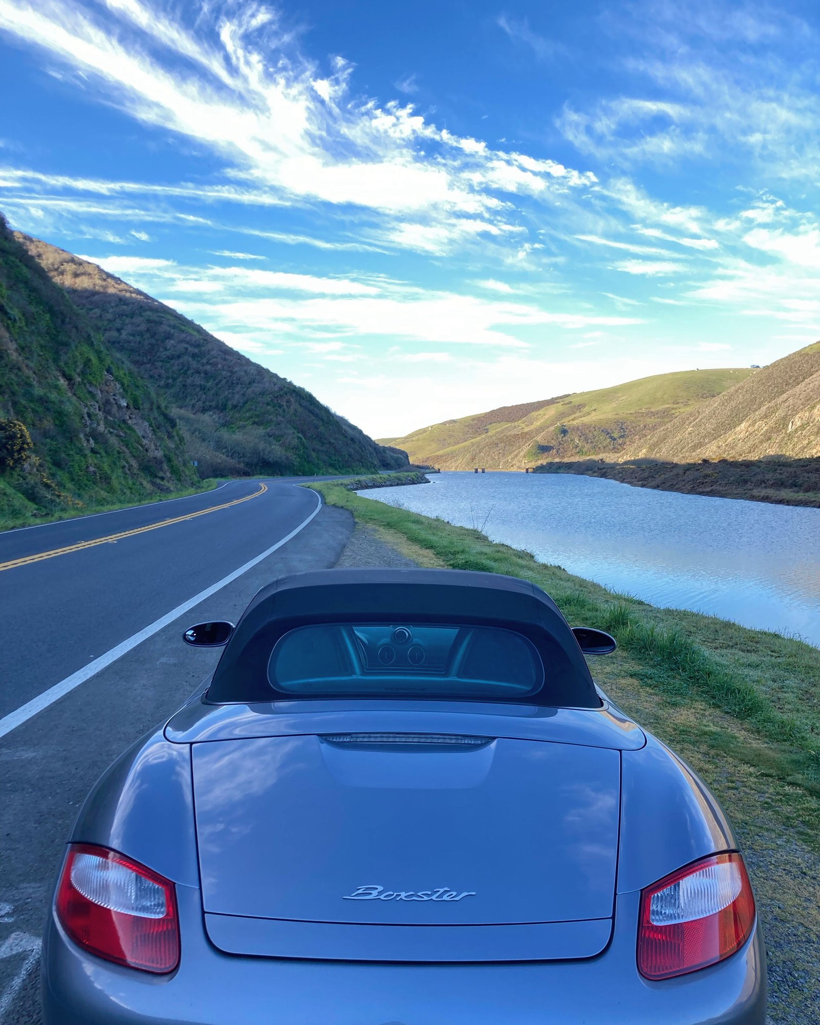
I did get some nice photos of my ND, so that was nice.
1 North from Stinson is only good VERY early and on Sundays. Panoramic from 1 to Stinson too.
Ridgecrest is heavy with cyclist traffic and is better for scenic stops than driving.
Suggest starting early and taking 1 further north and finding better routes back east to 101 including:
- Marshall Petaluma Rd.
- Tomales Petaluma Rd. and also Chilean Valley Rd (pavement not great but entertaining and great scenery)
- Dillon Beach Rd.
- Hwy 116
- (way further N. up 1) Skaggs Springs Rd. (****ty in the beginning but amazing 3 miles in back to 101
I ran the "Stinson Beach up to Ridgecrest Blvd. via Panoramic Hwy." route today.
In short, pretty terrible route and I would highly recommend not running it. Low speed limits, heavy tourist traffic, and some very rough roads. There's one 7 mile section that's extremely bumpy and full of potholes.
Congestion from other traffic/cyclists/etc. is a challenge with nearly all of the nice Bay Area roads, especially on the weekends. The only suggestion I have is..
Originally Posted by wjk_glynn
To enjoy many of these roads, you often need to be out there at the crack-of-dawn so as to find them mostly empty. If you leave it to later in the day, you'll frequently be inundated with cyclists/traffic/etc. That's just a fact of life when living in the SF Bay Area.
On the flip side, wildlife is more of a factor when you're out early. Had to hit the anchors reasonably hard to avoid hitting a deer on the backside of Mt. Hamilton last weekend, would have been about 6:30-7 am at the time.
But back to your drive yesterday, and the parts with poor surfaces...
Can you be a little bit more specific on which bits had the rough roads?
I'd like to add those to the notes in the top post.
Curvature helps those who enjoy twisty roads (such as motorcycle or driving enthusiasts) find promising roads that may not be well known. It works by looking at the geometry of every road segment and adding up how much length of the road is sharp corners, broad sweeping curves, and straight areas. The most twisty segments can then be viewed on the web or downloaded as KML map files that can be viewed in Google Earth.
Does curvature have information on road surface condition or smoothness? There�s a bunch of potentially fun mountain roads but some would be a lot comfortable with truck suspension.
also one lane two way roads in the SC mountains are ones that I take at a crawl. Bear Creek Rd or CA 35 from around CA17 looked theoretically interesting but fell into that category of taking it pretty slow for me
That's what I LOVE about this thread - there's no substitute for 'human intelligence'. Back when the pandemic hit in 2020 I made it a point to try all the roads on here, and it pretty much helped to keep me sane. Thanks for providing this resource!
One tip would be to check out Breakfast Club Rally who do monthly runs in the North Bay and often have interesting routes planned out. I'm sure there are South Bay equivalents of this too...
I live in Lucas Valley and my regular is LVR to Nicasio Valley Road to Pt. Reyes Petaluma N to Hicks Valley. At the T, go right and over Wilson Hill. Left on Chileno Valley Road to the end. Left on Petaluma Tomales Road to 1. Right on 1, stop at Tomales Baker for coffee and pastries. They open at 8.
1 South to Pt, Reyes, Station and on through to Olema. Left on Sir Francis Drake and over the hill and through Sam P Taylor. After you're out of the park, left on Nicasio Valley Road, right on LVR, return.
I like to leave early, like 7 or 8 am, well before the tourists, bicyclists and cops come out. I like to run it in that direction because the tourists will be coming the other way. If you'd like, heading up to Novato and heading out through San Marin, and heading out on Novato Blvd to Pt. Reyes Petaluma can be pretty entertaining, too.
Congestion from other traffic/cyclists/etc. is a challenge with nearly all of the nice Bay Area roads, especially on the weekends. The only suggestion I have is..
On the flip side, wildlife is more of a factor when you're out early. Had to hit the anchors reasonably hard to avoid hitting a deer on the backside of Mt. Hamilton last weekend, would have been about 6:30-7 am at the time.
But back to your drive yesterday, and the parts with poor surfaces...
Can you be a little bit more specific on which bits had the rough roads?
I'd like to add those to the notes in the top post.
Thanks.
Karl.
Howdy. I'm local to Marin.
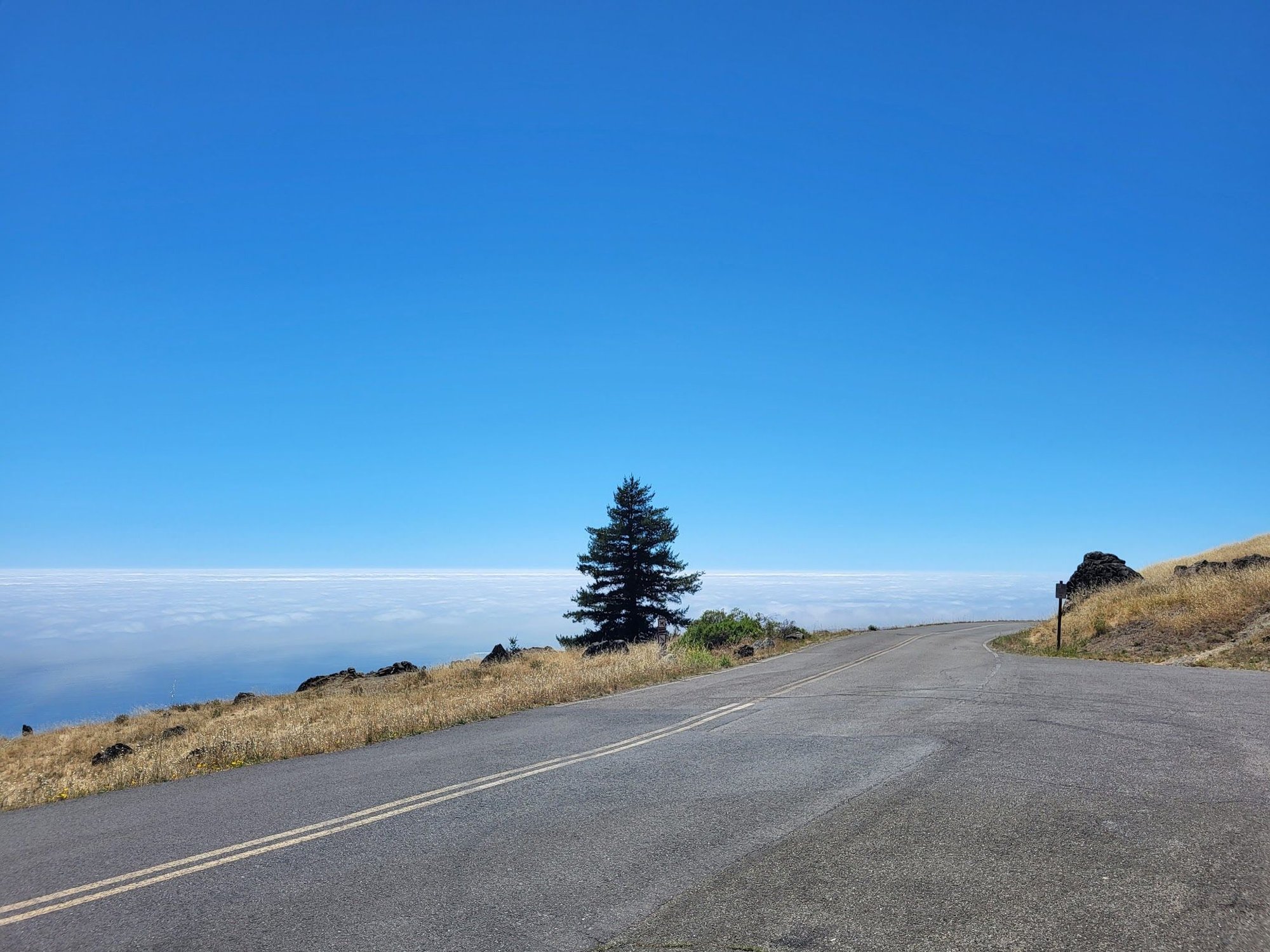
Panoramic is patchy and bumpy down near Stinson. Once you enter the trees, nightlines can be short and tourists coming the other way can crowd you, but the pavement is decent, though not perfect. It's still thrilling and the pullouts on the switchback set before you head up into the trees is a prime photo opportunity, especially if there's a little fog below.
If you're coming up Fairfax Bolinas from 1, this road is also very bumpy and often broken up or heavily patched, especially as you near the summit. where it joins Ridgecrest. If you take the left and head down to Alpine Dam and into Fairfax, the road is narrow and has many heaves and patches of lumpy pavement. But it's a beautiful drive through the redwoods and you get to drive across the dam. Macan or Cayenne country, IMHO.
My suggestion for driving in Marin is to get up early and get north. Take your pick of routes south. The tourist traffic which is all headed either west or north.
22 years worth of Sunday mornings playing in these hills, I hope that's helpful.
And always watch for deer traffic around water crossings or where deer can cross the road for water.
I live in Lucas Valley and my regular is LVR to Nicasio Valley Road to Pt. Reyes Petaluma N to Hicks Valley. At the T, go right and over Wilson Hill. Left on Chileno Valley Road to the end. Left on Petaluma Tomales Road to 1. Right on 1, stop at Tomales Baker for coffee and pastries. They open at 8.
1 South to Pt, Reyes, Station and on through to Olema. Left on Sir Francis Drake and over the hill and through Sam P Taylor. After you're out of the park, left on Nicasio Valley Road, right on LVR, return.
Let me know if I've integrated your comments correctly...
He had specific notes and recommendations, so best to read his post for more details
To the above, adding the loop of Nicasio Valley Rd / Pt. Reyes Petaluma Rd / Hicks Valley Rd / Willson Hill Rd / Chileno Valley Rd / Tomales Petaluma Rd / Hwy-1 / Sir Francis Drake Blvd / Nicasio Valley Rd - https://goo.gl/maps/gQCdz86pbJkRYJ1t8 (~61 miles)
Looks great. Thanks for all the work maintaining this. I’m sure it entails quite a bit.
Also: PG&E is doing utility work on Lucas Valley. Work starts at “the bowl” on the west side of the Big Rock and continues about a half mile. Westbound side has a patched up trench for most of the way. Periodic lane closures Mon through Saturday, so early Sunday is best.
This is more of a Morning until evening drive as round trip it would be aabout 8-9 hours.
I planned this drive for a group of friends about 2-3 years ago but havent been actually able to do it looks like this summer will be the time to go.
Inspired by Need for Speed movie in the ending scene where the final race was shot at in Mendocino County
Meet Location Address:
361 3rd St, San Rafael, CA 94901
We will want to meet up by 8:00am at this location so will need to leave your area by 6:30/7am
From Southbay, it will take about 1 hour - you will take 680 to 880 to 580
From San Francisco it's 30 minutes.
Once we meet at the San Rafael meet up spot, we will proceed North to the starting point of where the final race scene begins in Ukiah, CA
Distance from Meet spot to Ukiah - 95 Miles 1 hour 50 mins
Once we get to Ukiah, this is where the fun begins. The start of the race begins at the 253 in Ukiah and follows through Boonville High 128 which is the California Redwoods. This is that nice scenic race scene between the giant Redwoods. We will then hang a left onto Highway 1 and head South to the Lighthouse.
This section is 72.8 Miles and will take about 1hr 45 minutes
Here is a google map link for the Need For Speed Drive sequence only from Ukiah to the Lighthouse:
The total drive time to from South Bay to the lighthouse is
about 5 hours give or take cause we will need rest stops and meet time and other take a break to enjoy the view or rest your butts time.
Our Target time to get to the lighthouse is 12pm-1pm.
After wards, we will descend home along High 1 South. The entire Highway 1 South is 138 miles to get into San Francisco and is about 4 hours. We can cut 30 minutes off by getting onto 101 also which we might have to do if we cant find gas stations along the way.
Total drive time for this trip is about 9 hours total driving. Expect to be back home in the evening.
Drove part of the route as indicated on the google map this weekend...
1. The 253 portion was heavenly - great surface, combination of sweepers, hairpins, elevation, scenery, and very little traffic
2. Google helpfully adjusted my route through Mountain View Road instead of north on 128 - in case you are tempted, that section was a pretty hellish goat path - extremely broken up and bumpy surface beat my car to death.
THANKS GOOGLE
3. Upon reaching 1 I went north and came back down 128. That is also an incredible road (at the right time in the morning).
Synopsis: Incredible route but don't rely on Google Nav!
Picture Caption: this is the only smooth part of Mountain View Road
has anybody mentioned Mines Rd. from Livermore to highway 130/San Antonio Valley Rd. down Mt. Hamilton into San Jose? I've been to pretty much every "driving road" in the greater bay area and if there is a better route (especially after the repave on Mines), I haven't seen it

 03-20-2022, 06:58 PM


")