When you click on links to various merchants on this site and make a purchase, this can result in this site earning a commission. Affiliate programs and affiliations include, but are not limited to, the eBay Partner Network.
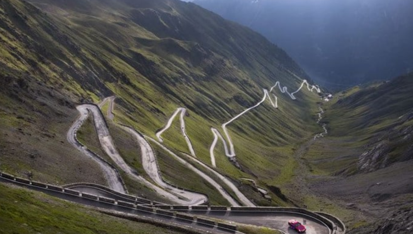
OK, not having been to Tail of the Dragon, I thought I was simply sharing a great photo. I pulled this from a FB post. So the location could be wrong. Sorry if I screwed up here. Can anyone actually confirm where that photo was taken? Now I'm curious.
Personally, (and nobody asked me)... I am anything but impressed by TOTD.
Yes, there are 11 miles of 318 nicely linked turns, but also so many poseurs f-ing up there: https://tailofthedragonmaps.com/tail...dragon-deaths/
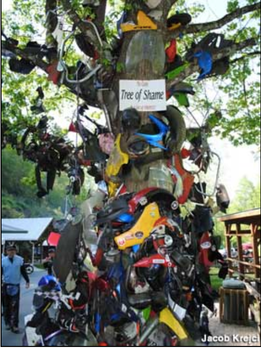
Or stop and check out the "Tree of Shame" body panels outside Deals Gap at the beginning of the stretch.
Hardly a world class road worthy of the detour I made to fill a square on our ATL-LAX post Porsche Euro delivery road trip.
If you live in the Southeast US, it might be the bees knees, but the Rockies, Sierras, Cascades, Tetons and Cali coastal range are really a different universe as far as driving roads. Or the European Alps, for that matter.
Sorry to step on anyone's toes who thinks otherwise, but treating it like some holy grail of great driving roads is not warranted.
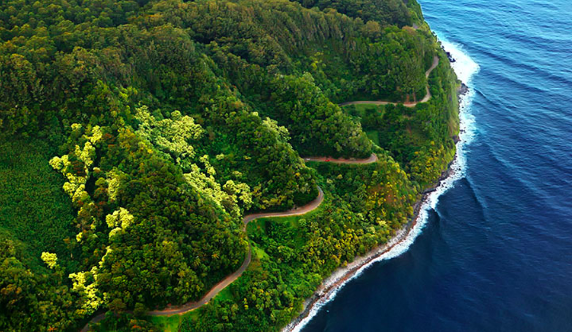
Cripes, even Maui has better driving roads, in the middle of the Pacific Ocean:
Haleakala Highway (37 miles):
Or the Hana Highway (52 miles):
Last edited by Liste-Renn; 11-03-2021 at 10:31 PM.
I�ve done the Hana Highway twice. I think I�m all set with that. The backside where it�s basically a one lane gravel road with the Pacific on the left and rock face on the right�..nah. No more for me. Now, I still need to make the buttcrack of dawn trip up Haleakala to see the sunrise someday.
I did TOTD on my way home from picking up my 911. Tuesday afternoon around 4:30. Just started to rain. There were a handful of cars, but all headed in the opposite direction. So I could take my time or go as fast as I wanted. One clown in a Miata came around a corner pretty quick and close, but other than that, I enjoyed it.
Last edited by TerrestrialFlyte; 11-04-2021 at 01:16 AM.
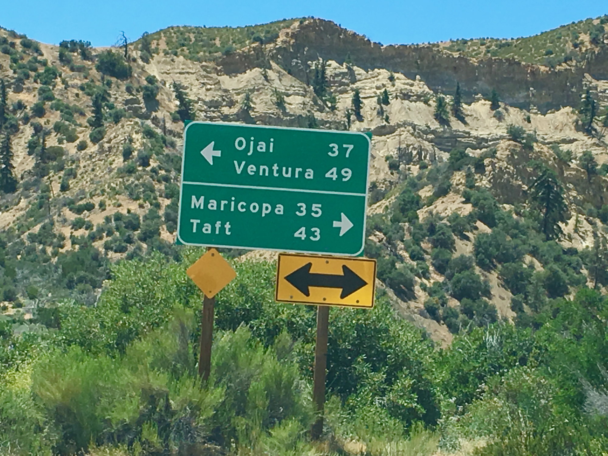
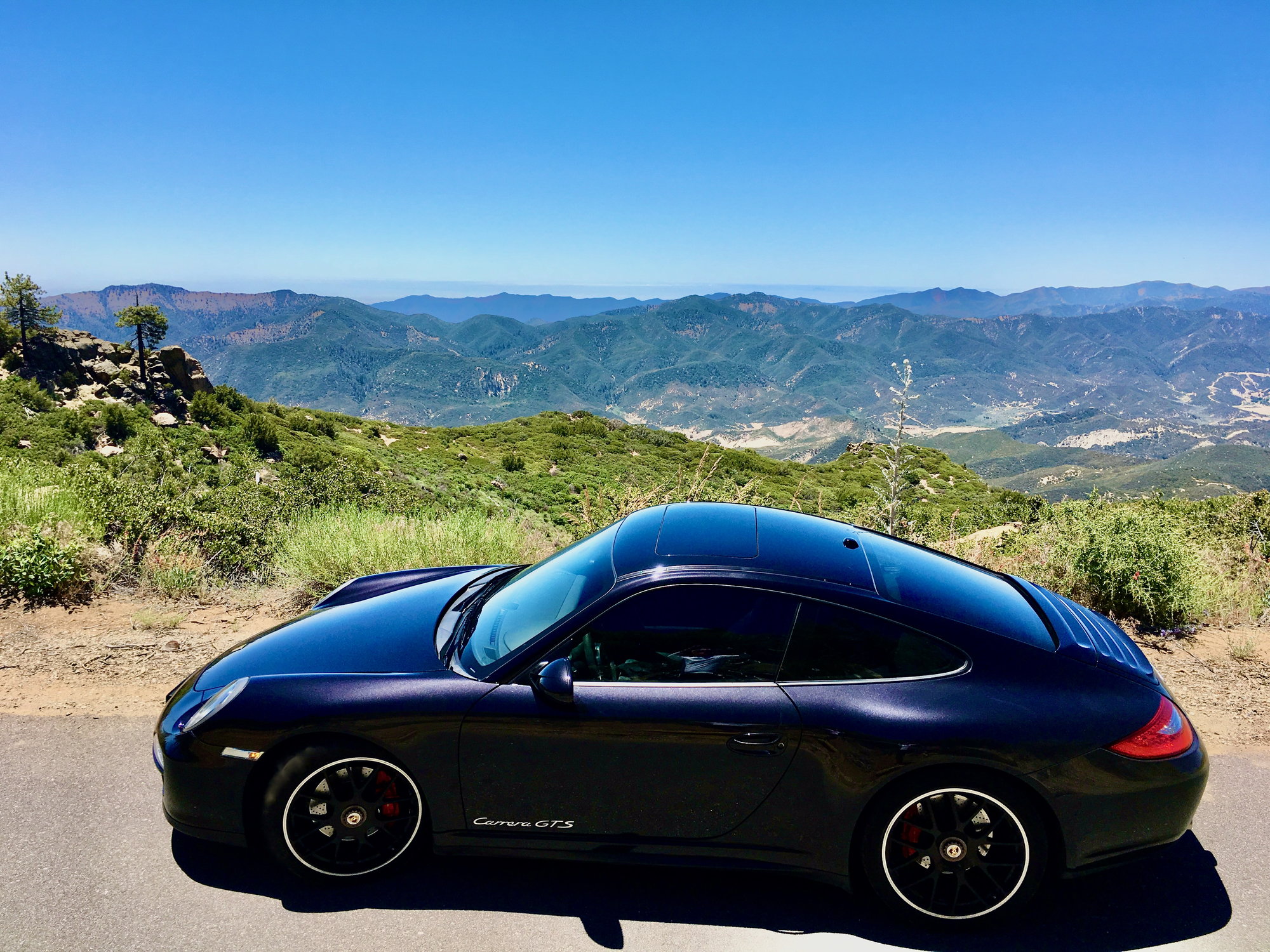
Pete found a link that indicates the picture this thread started with was in fact TOTD. But the traffic conditions do look horrid. Sunday some of us drove south out of Santa Barbara up to Ojai north on the 33 and west on the 58 on the way back to the SF Bay Area. It's tough to beat a drive like that. We are blessed with some nice roads to enjoy our cars on.
Wayne, spot on comment: "Sunday some of us drove south out of Santa Barbara up to Ojai north on the 33 and west on the 58 on the way back to the SF Bay Area. It's tough to beat a drive like that. We are blessed with some nice roads to enjoy our cars on."
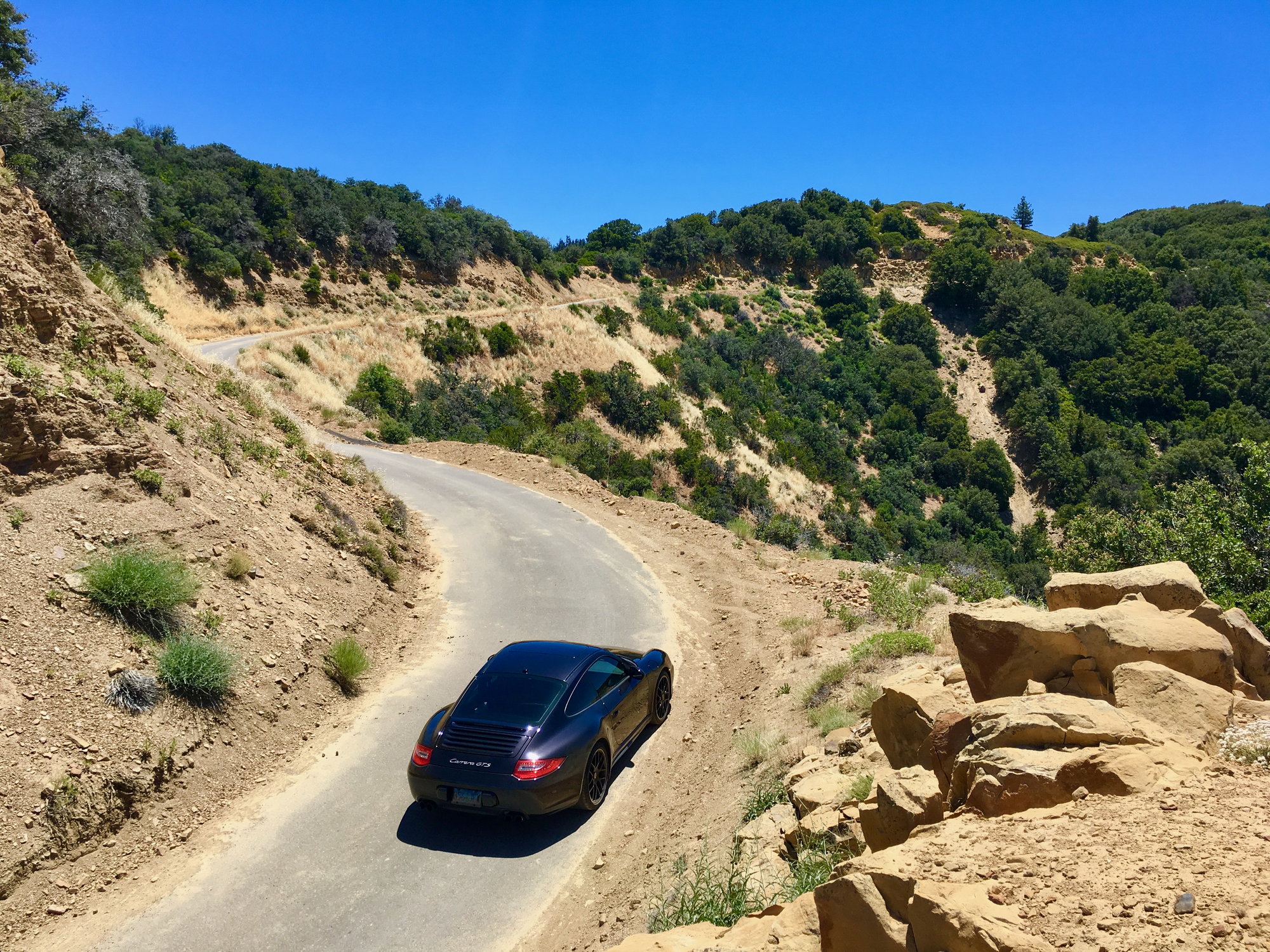
Highway 33 north of Ojai is plain badass. The Maricopa Highway, as it is called, is sublime and drive-able 12 months a year.
It is one of my "go to" routes in SoCal- the others being the Malibu Canyons, Angeles Crest Highway, Big and Little Tujunga Canyon and Highway 1 (Pacific Coast Highway, or PCH) north of Santa Monica all the way to San Francisco. It continues all the way to the Straight of San Juan de Fuca on the Canadian border- just beyond compare.
The southern Sierra Nevada has dead end box canyons that preclude heavy traffic- they are akin to a closed course racetrack with spectacular views and zero the repetition of a race track.
Last edited by Liste-Renn; 11-04-2021 at 05:12 AM.


 11-03-2021, 06:08 AM