When you click on links to various merchants on this site and make a purchase, this can result in this site earning a commission. Affiliate programs and affiliations include, but are not limited to, the eBay Partner Network.
I'm planning on doing some country/mountain drives which have been recommended but am trying to figure out the best way to translate a highlighted route graphic into a turn-by-turn spoken route I can follow using my phone. Ideally, it would be something that allows me to plan the drive on a real computer and then send to my phone to actually navigate it. I know Google maps is highly recommended, but it only allows 10 waypoints/stops and that's not nearly enough. The last route I drove with friends had 134 turns over 118 miles and I had to rely on a printed copy of the instructions. I had a navigator who could tell me what was coming up, but I'm looking for something I can use solo. Anyone have any good experiences or recommendations for a particular app? Thanx in advance.
You are correct that Google maps limits you to 10 stops but there are workarounds available. Google "maps more than 10 stops" and you'll see an array of options. It would be difficult to do it on a phone though so that might be a problem.
This is called "The Traveling Salesman" problem, and unless you have a quantum computer (or pay for a cloud service that does), you won't be able to add more stops than google maps. This is actually the short of what happened to Southwest in December, once their system crashed.
Actually, the OP has not raised "The Traveling Salesman" problem.
The Traveling Salesman problem asks "If the TS has to visit 10+ cities and return home what is the shortest route?" The OP isn't asking for the shortest route. He's just asking to plot the route. Google maps doesn't even try to optimize the route to the best of my knowledge. It just maps the waypoints in the sequence selected by the user. (Google "map with more than 10 stops" and you will find hacks to exceed Google's 10 stop limit.)
You are correct though that 10 is something of a cut-off between doable and really hard as the number of possible paths grows exponentially (or at least really fast) as additional stops are added. .
Nonetheless, Mapquest Route Planner can "optimize" up to 26 waypoints as fast as I can type them in. It's most likely that they haven't truly optimized 26 waypoints as that requires substantial computing. However, there are ways to get an answer that is close to optimum with far less calculating. I suspect that's what Mapquest does.
Following. As someone who found the "GTS Routes" (now "Roads") app a few years ago and has had a very love/hate relationship with it, I'd love to find an app that actually does help me find good driving roads.
Although one other thing I really did like about the Porsche Roads app is that it allows for route sharing. I have found some good driving roads through the app, but navigating them is a pain. It's better now than it was, but I'd still only put it at about a 3/10 for usability.
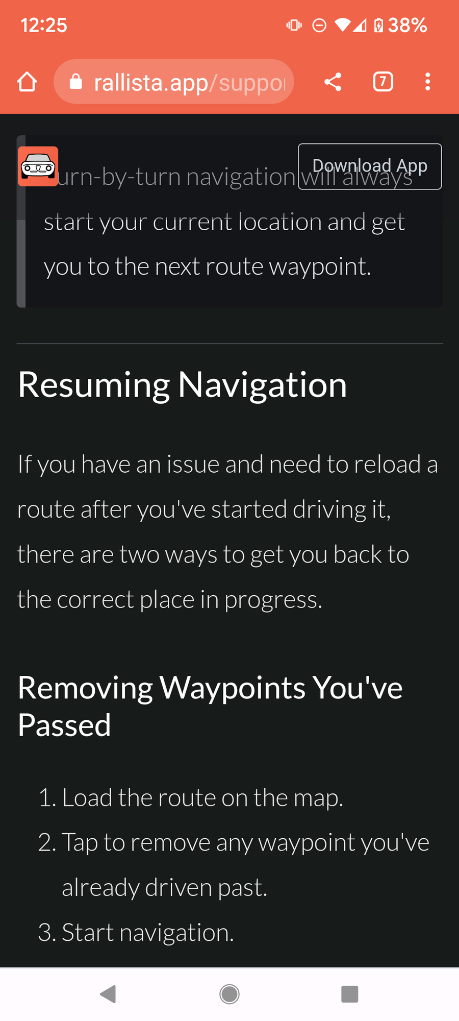
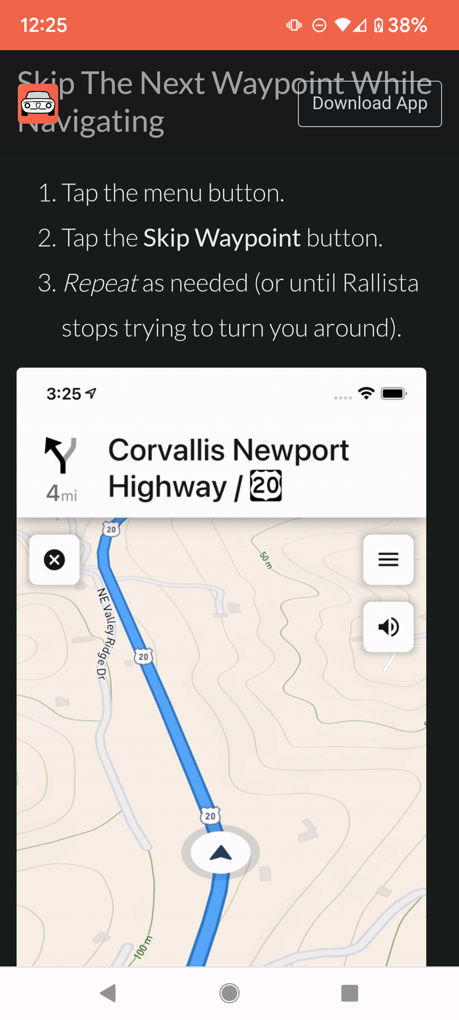
Heard back from Rallista. The fee-based app will accommodate 300 miles with 250 WPs for $2.99 per month (recurring charge) for an individual (not for profit as they said in their response) account.

 03-12-2023, 01:27 AM