When you click on links to various merchants on this site and make a purchase, this can result in this site earning a commission. Affiliate programs and affiliations include, but are not limited to, the eBay Partner Network.
There is a small amount of good science in the movie. The part about disrupting the great oceanic conveyor belt current is real science. The part about air bubbles (fossil air from way back in the last ice age) in ice cores with lower CO2 gas content than present atmosphere is real science. Freeze drying helicopter pilots with some not-going-to-happen super cold down draft in the eye - NO. Three storms is unusual, but it's happened in the pacific not long ago. The storms won't link up. They are distinct entities that create very unique air flow around them. If you go here you can watch it.
Yup! It's pure visualization. I use it with my students and just ask questions to focus their observations...they learn it better than from a book. LOTS can be taught with it, including some advanced topics that become easy to grasp due to the animation of the winds.
Originally Posted by Majestic Moose
Thanks for that link. I am a visual learner and gained more from playing around with this than any book I could have read about weather. Fascinating.
I'll drop this in here and start a thread in the Off Topic area. Here we go again...
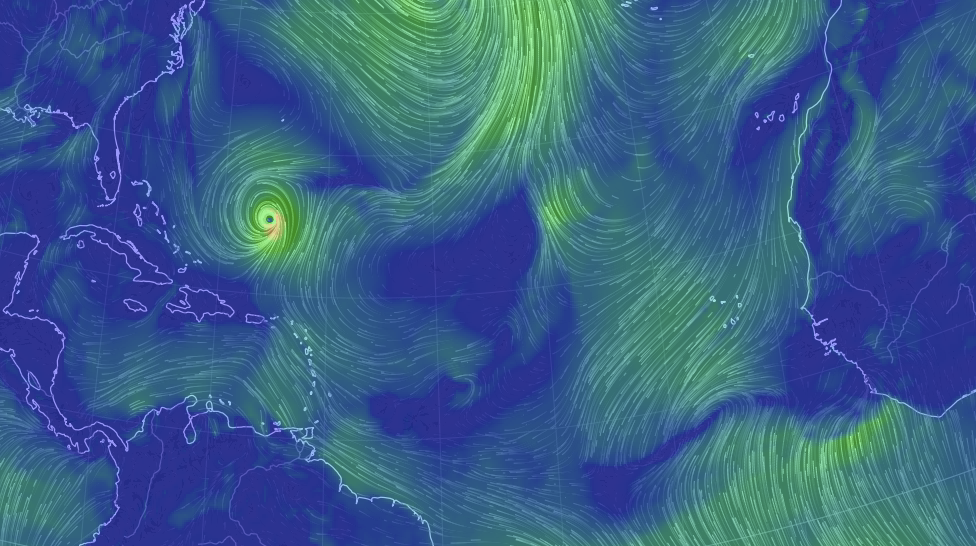
NOW...just Jose
Tomorrow a tropical wave starts to rotate off the coast of Africa. By Sunday it's starting to look like a repeat of Irma (very rapid development). But, I'm pretty sure Irma, given it's record breaking size, has reduced the energy available...so I wouldn't expect another Irma. This doesn't exist yet or have a name....but over the years I've noticed these models are really good at anticipating where storms will pop up. (note there's a tropical storm/hurricane in Baja by the weekend).


 09-11-2017, 11:59 AM