When you click on links to various merchants on this site and make a purchase, this can result in this site earning a commission. Affiliate programs and affiliations include, but are not limited to, the eBay Partner Network.
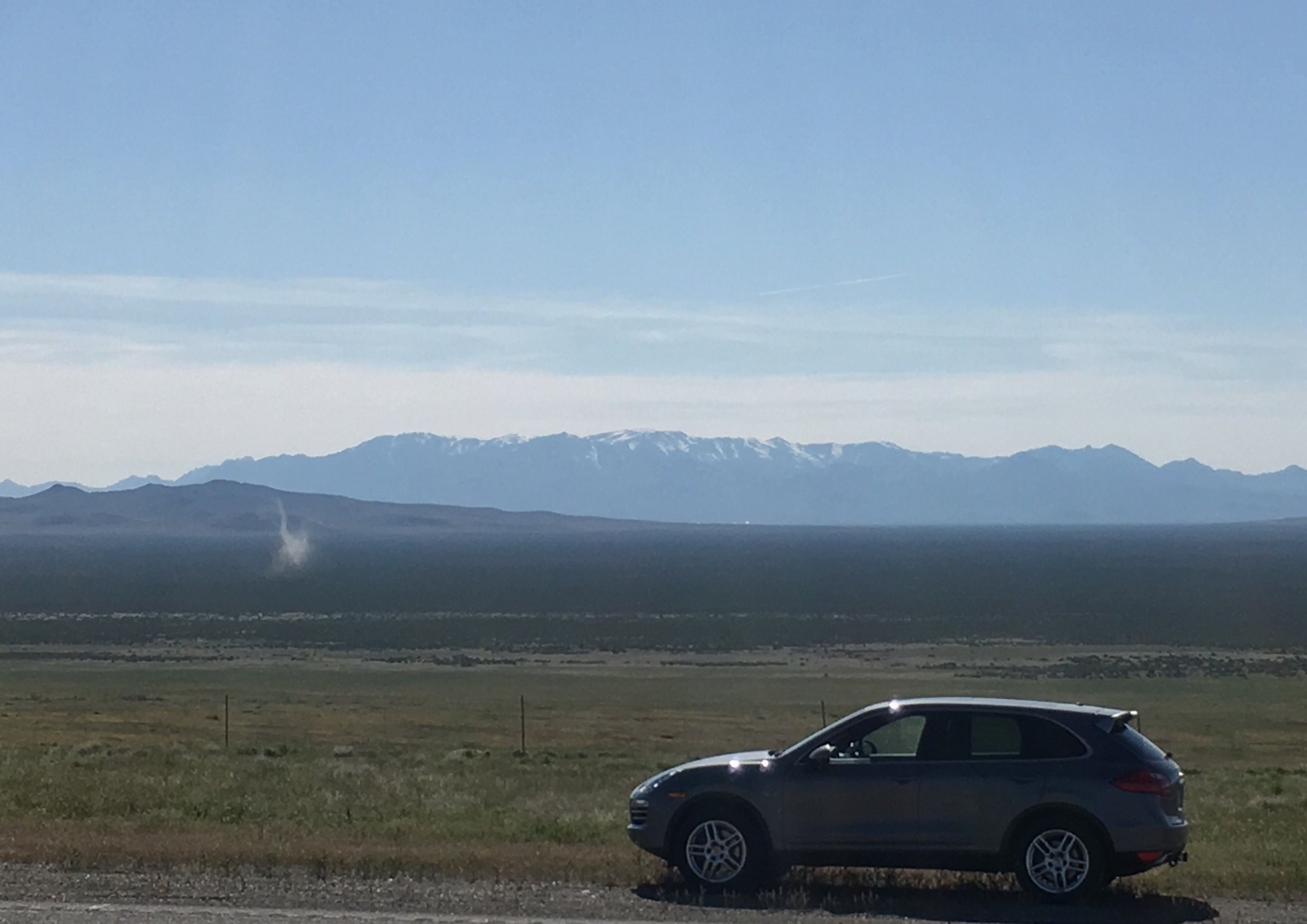
On the move again! Heading south mostly from Boise picking up US 95 from Idaho into southwest Oregon. This is really remote country evidenced by a "last gas for 70 miles" sign. They were not kidding. Interesting terrain though. We stopped just into Nevada for a photo that shows sagebrush that is actually green in the distance and the remains of a dust devil. Heading to Lake Tahoe today so photo ops should be abundant.
To approach Lake Tahoe, we drove south from Reno a bit and turned on Nevada 431, the Mt. Rose highway. It climbs about 4,000 feet with numerous turns and switchbacks. Two Porsches, a Cayman and Boxter, passed me on the way up and I'm pretty sure the drivers were grinning. Once over the top there is some downhill before you have your first view of the lake and it is spectacular.
.... Even thought I am SURE your wife is laughing at you, every time you climb a rock ledge to get just the right angle, sunlight & pano view,... please tell her that we all think it is SO worth it.
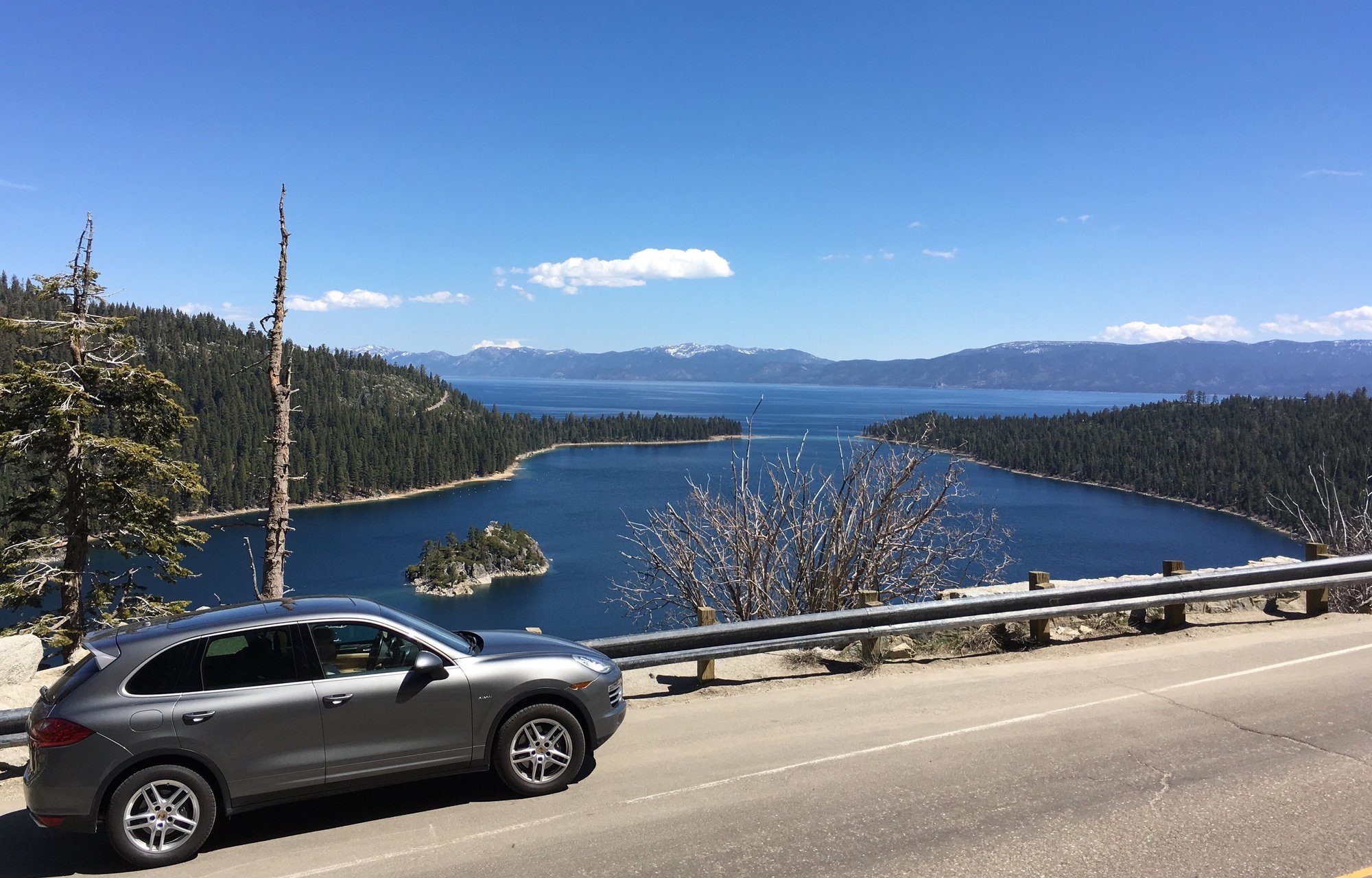
Steve, my wife got a chuckle from your comment for sure. Before we saw your post, we had stopped at a wide spot in the road overlooking Emerald Bay at the south end of the lake. The road there is very narrow and at one point is built on the narrow crest of the mountain such that there are two lanes of blacktop, no shoulder whatsoever, and practically a vertical drop on both sides of the road.
Anyway, there was a place to pull off with the bay below us so I needed to be across the road and above the CD in order to get the shot. Unfortunately there was pretty much a vertical rock face there, but I started to climb up best I could anyway. I managed to get about 10 feet up so I pulled out my iPhone for the photo and at that moment I started to slide down the tiny ledge I was on and commenced an unplanned slightly controlled decent which my wife witnessed. I managed to land on my feet so I went up again to get the shot below.
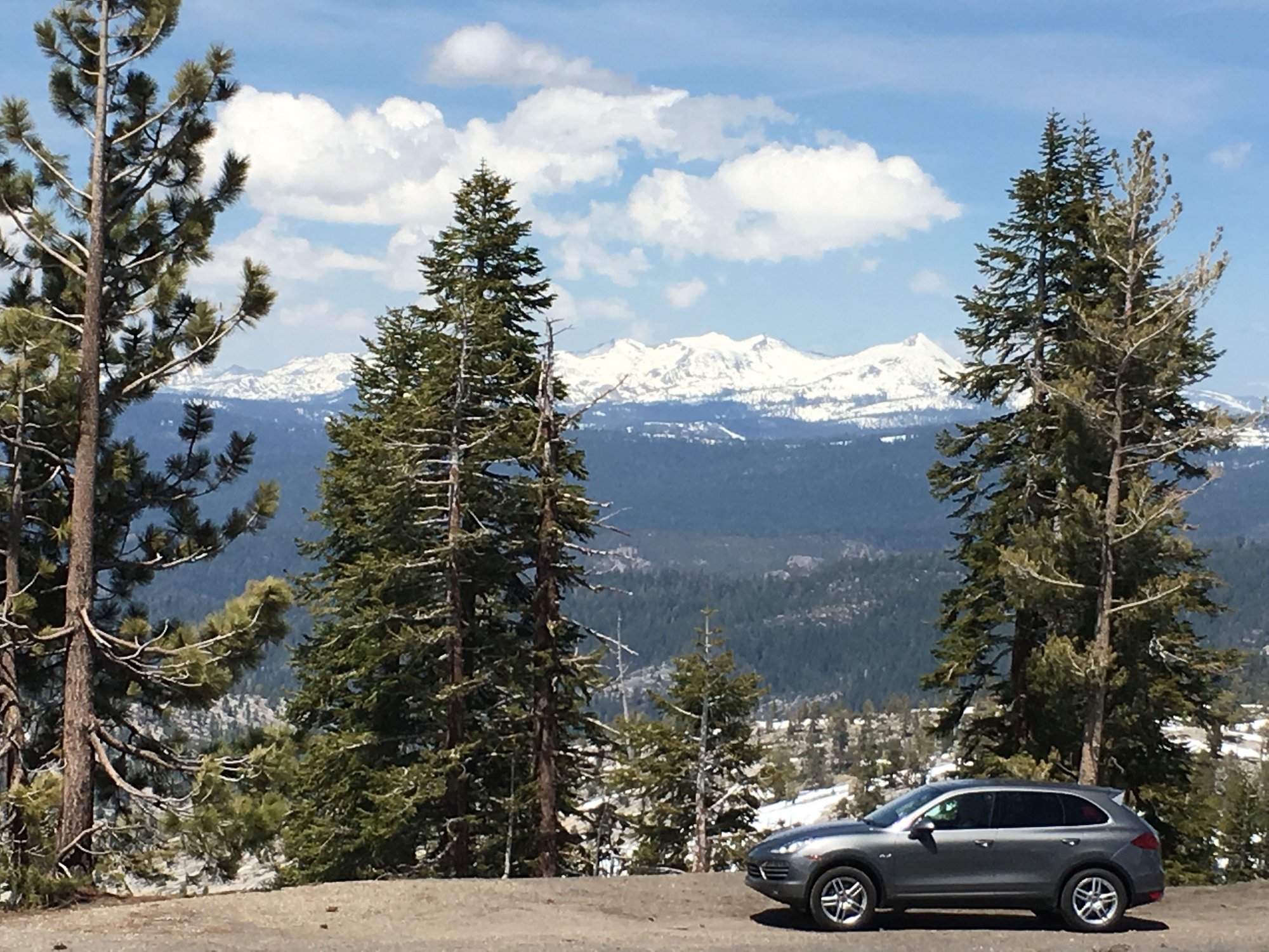
From Tahoe we drove CA 89 then hung a right on CA 88 toward San Francisco. CA 88 passes the Kirkwood ski resort (I've skied there and liked it a lot) on its way to the San Joaquin valley. The road generally follows a ridge line from around 8,000 feet down to the valley floor with hardly has a straight stretch anywhere. Being on a ridge, we were treated to views off both sides of the road the whole way.
Hills of a different sort today. We have made our way to San Francisco to visit our wonderful daughter and she showed us around the city. In the process of checking out some open houses, we crested a hill and came upon this view of downtown.
If you ever drive to San Francisco and really don't like the claustrophobia and expense of staying in the city, we found a hotel that works very well. The Acqua hotel is just off of US 101 only four miles north of the Golden Gate Bridge. It sits on the bay, is very easy on/off the highway, has free parking, is very pet friendly, and probably costs about half what it would to stay in the city. Easily the best hotel we've stayed in on this trip.
says Mtea - "Honey, jump out with the camera & go stand on the street corner over there while I circle the Cayenne round in this intersection!! Hurry, no cars yet!!!,.. oh & don't get run over please!"
great pic. Took the family there just last summer & absolutely love that city & surrounding areas.
Steve, the more likely (and actual) scenario is that I'm amusing myself during the open ended wait time while wife and daughter walk through an open house with views if the city and bay. Another is "Honey, I'll feed and walk the dog then buzz down to take a few photos of the Golden Gate Bridge while you get some extra beauty sleep". That one didn't happen because I'd have had to wake her up, but I was thinking it.
This shot again involved some scurrying up the rocks but the risk was worth it.
Exit San Francisco; head east to Yosemite. Once near Stockton we stayed on CA 120 to approach and enter the park. I've talked a bit about twists and turns in various roads so far, but for now Old Priest Grade on CA 120 takes the cake. On the way in I didn't know what the old grade was so I went up the new grade which rises around 1500 feet and is very twisty. I did see the road on the opposite side of the canyon on the way up. Because several of the mountain passes were closed (including on 120 which was not well marked) we had to go back the way we came.
On the way back I did take the old grade, and it was steep, really steep. It is something around 2.5 miles long and I went down in 2nd gear and I still had to brake. I looked it up and the average grade is 12.9% and approaches 20% in some places. It would be a blast to go up the old grade in a car. In the picture below, the old grade is outlined in blue.
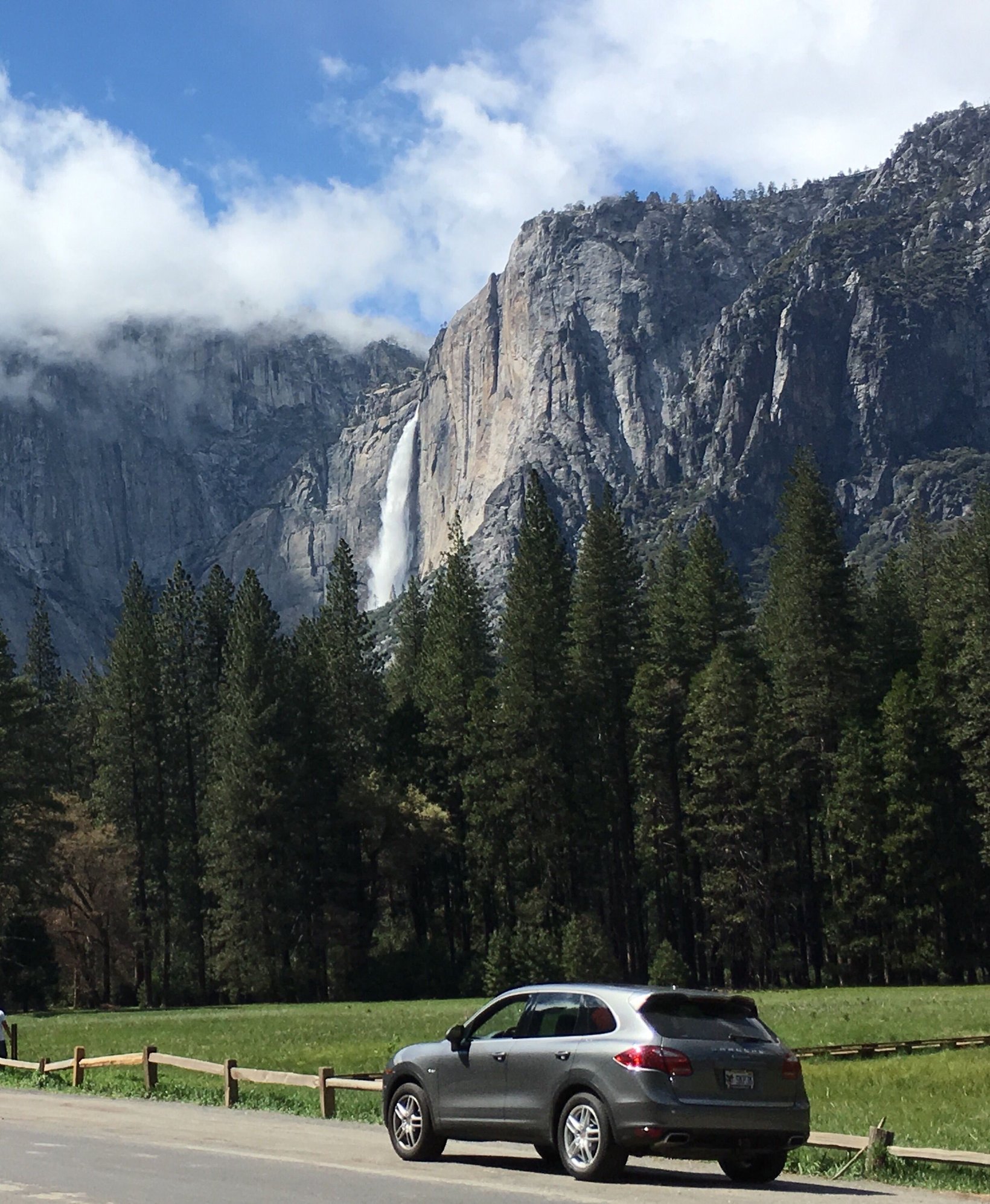
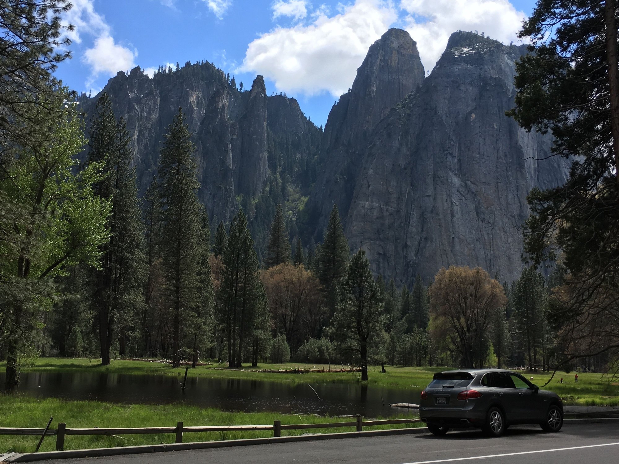
Yosemite Valley was beautiful. I recommend visiting in the off season as it was starting to get crowded in some places already. I've included a couple Yosemite photos below. May be more to follow after I get a chance to sort through the rest.
We can't leave Yosemite without a couple more photos. When we drove into the valley it was unexpectedly snowing for a bit, then there were clouds hanging low so I thought our views might be obstructed. As we drove further in, the clouds lifted and there it all was. What we did not expect was the damage done by forest fires along the way to the park and even to an extent in the valley. Tons of acreage burned.
Yosemite Falls drops 2,425 feet to the valley floor.
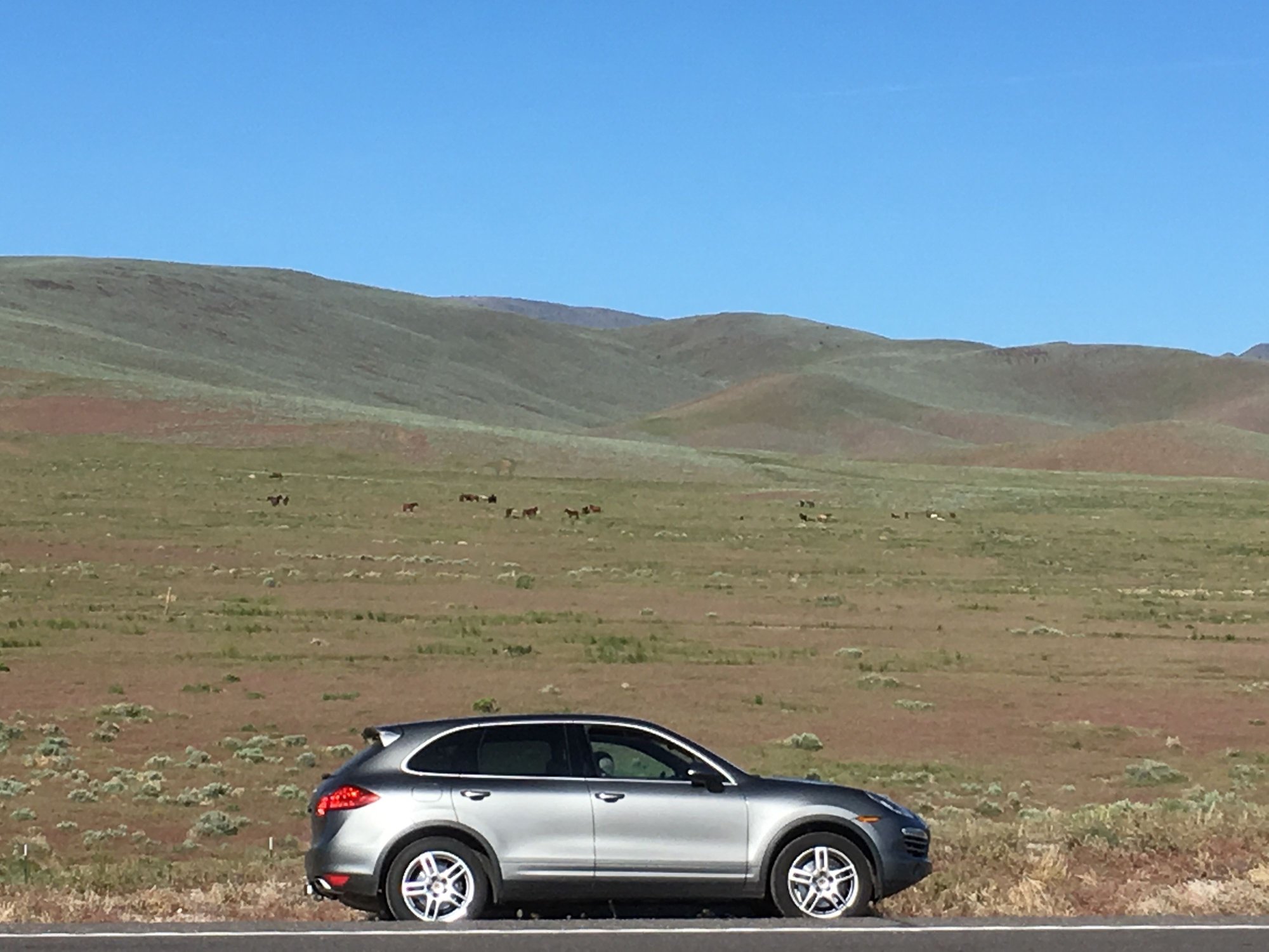
On the drive back north, again avoiding freeway, we saw something that neither of us have ever seen before. We were on US 50 in Nevada between Silver Springs and Fernley when we noticed highway warning signs to be alert for wild horses. Having never seen that sign before we kept scanning around and a few miles later there they were - around 100 wild horses in several groups off the highway to our left.
We turned on to the shoulder and pulled out our binoculars for a closer look. I grew up on a farm and my wife rode horses when young so it was easy to see these were wild horses. All their tails were down to the ground and their manes completely covered their necks. No grooming here. And they were a jumble of colors - pintos, bays, palominos, buckskins, sorrels, chestnuts. On a hill overlooking one group there was what appeared to be a black stallion. Very cool.
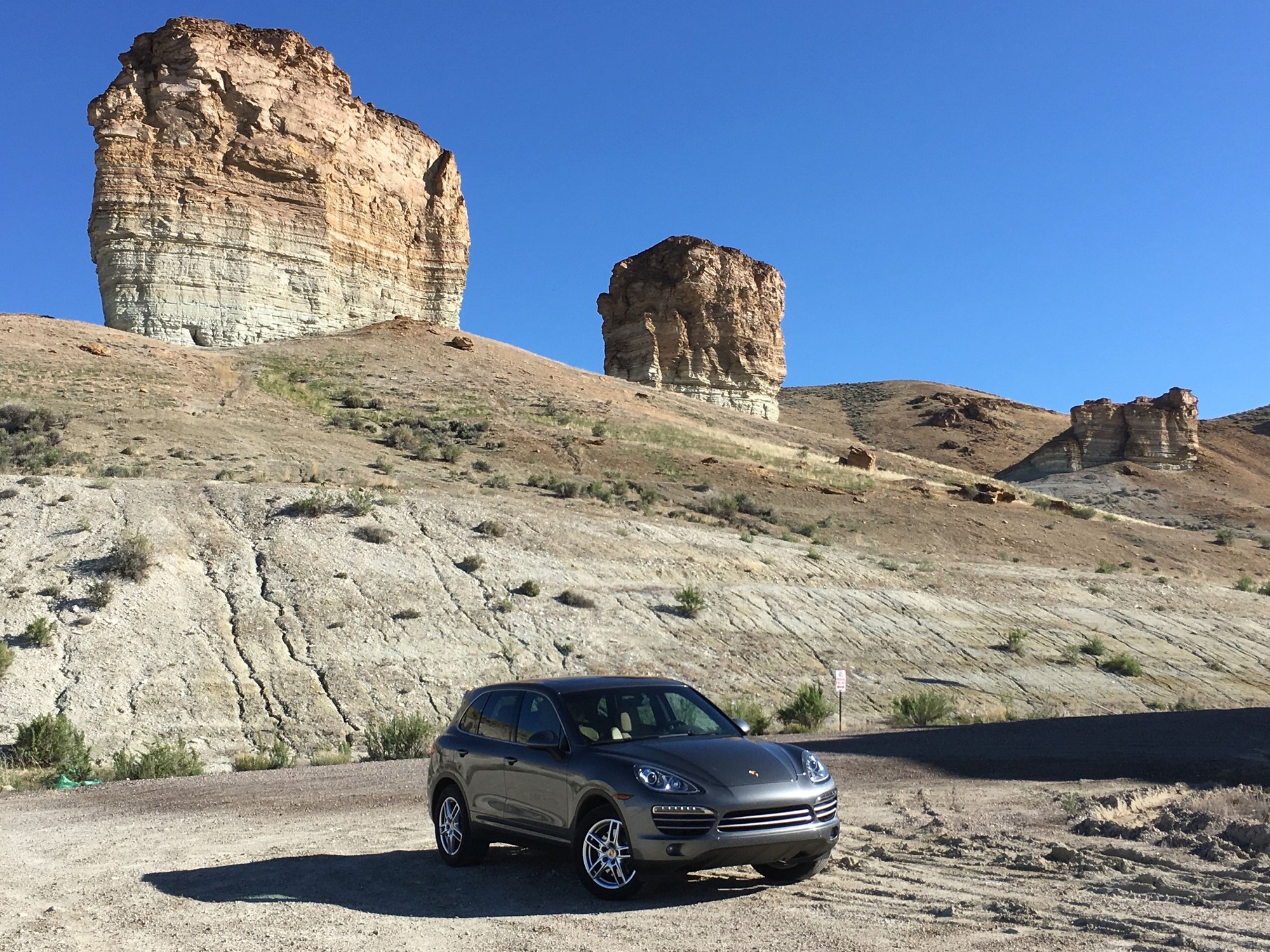
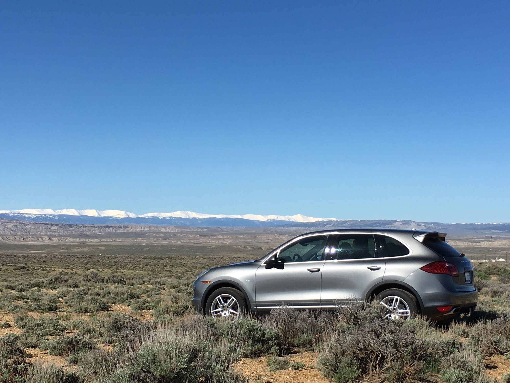
Back in the CD again left Idaho and stayed at Green River, Wyoming. Took the first snap below right outside of our hotel. Had a few photos as we headed south toward Vernal, Utah through the Flaming Gorge national recreation area. Great weather and super views.
Rock spires at hotel.
Pulled off into the sage brush. Uintah range in the distance.
Laranja, it has been epic for sure and we've seen some unexpected sights by avoiding the interstate. We were winding down US191 toward Vernal, Utah and saw a rough dirt track that went up a hill off the switchback so we took it. Wife thought it was a runaway truck ramp but I assured her it would have been a truck jump. We climbed up through the rocks to a grassy knoll and got the picture below. What a view.
How many of you have even heard of Vernal, Utah? I hadn't. I've been there twice now. We retraced this route because I missed a lot of it the first time due to the complete whiteout snow storm I described the first time through.


 04-20-2016, 12:34 PM